Demanding walks
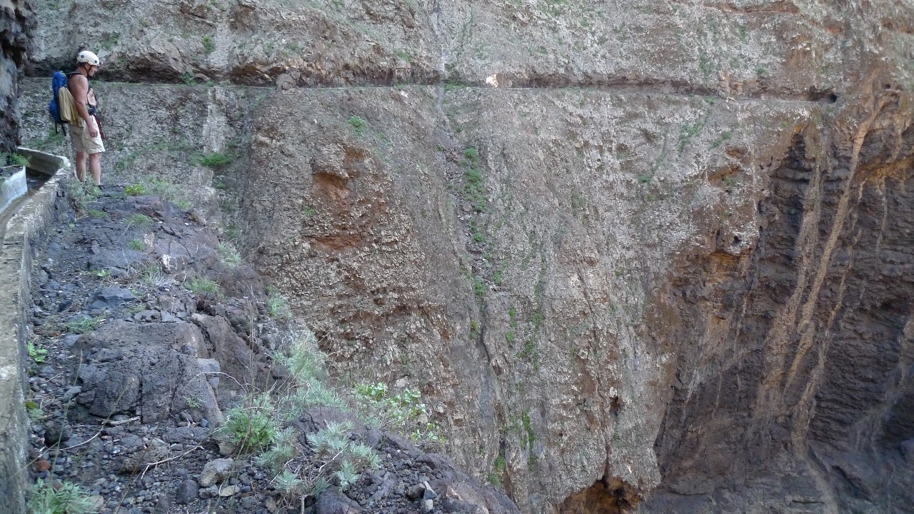
The following walks belong to our standard tour program and require participants to have some skills in climbing and off trail navigation. Parts of the walks go along waterchannels that lie in steep mountainsides with high cliffs below. A torch (preferably headlight) is required on all trips.
Walk 5.) Los Gigantes - barranco Mancha de los Dias - ravine of Natero - canal de Natero - back to Los Gigantes. Aprox. 21 km. 550 m accent/decent. 4-7 hours.
Follow the cliffpath to the clifftunnel and trough this, the trail in Barranco Mancha de los Dias is followed up to the dry river bed on the left side (west). The riverbed is followed up to the tunnel galeria el Sauce. This tunnel is about 800 m. long, and leads us to bco. de Natero. The trail in the bco. de Natero is followed down to the canal de Natero which is followed back to the cliff tunnel and the cliff path back to Los Gigantes.
Walk 6.) 5 long and inumerous short tunnels. Camino rejal - Tamaimotunnel - the white waterchannel - barranco de Natero - upper Mascatunnel - barranco Masca - canal de Masca - lower Mascatunnel - canal de Natero - Los Gigantes. approx 23 km. 550 m. Accent/decent. 5 - 8 hours.
The Camino rejal is followed to the Tamaimotunnel. Go through to barranco Mancha de los Dias. Climb up to the white water channel and follow this to galeria el Sauce. Go through this to barranco de Natero, which is followed down to the upper Masca tunnel. This leads to barranco Masca. The tourist trail is followed down to the canal de Masca. The water channel is followed to the lower Mascatunnel, through this to the canal de Natero, which is followed back to the cliff tunnel, the cliff path and Los Gigantes.
Tur 7.) - Cliffpath - clifftunnel - barranco Mancha de los Dias - Seco beach - barranco Seco – path to canal de Natero and back to Los Gigantes. aprox. 15 km, 200 m. accent/decent. 4-5 hours.
Follow the cliffpath, clifftunnel and water channel in Barranco Mancha de los Dias until the path descending towards the sea is reached. The path and dry river bed goes down to the sea and playa Seco (cobblestone beach). The Playa is crossed northwards to Barranco Seco. Barranco Seco is followed partly in dry riverbed, partly on path (good path in the upper parts), and leads up to Canal de Natero . This is followed back to the clifftunnel, the cliffpath and Los Gigantes.
Walk 8.) - The cliff path, cliff tunnel, water channel, lower Mascatunnel, and bco. Masca down to the sea. Boat back to Los Gigantes. about. 13 km. 300 m. accent/decent 4 - 5 hours.
Tickets for the boat back are bought before the trip starts! The cliffpath is followed to the clifftunnel. Go through this to the canal de Natero which is followed to the end. The path in Barranco Seco is followed up to the crossing of the water channel that descends steeply from the left (north). Follow the water channel up to the lower Mascatunnel. Walk through the tunnel and a couple of hundred meters. Look for the cairn right below the water channel marking the beginning of the path down in Barranco Masca. Follow this down to the tourist trail which is followed down to the sea.
Walk 9.) Los Gigantes - Santiago del Teide - cruz de Gala - Baracan - Teno Alto - punta Teno. approx. 28 km. accent/decent 1200 m. 6 - 8 hours.
Camino rejal is followed to Santiago del Teide. Road and path to Cruz de Gala. Continue on until the path crosses the Mascaroad. Then steep climb to the mountain Baracan. The path continues gently down to Teno alto. Road and paths are followed to the punto Teno main road which is followed out to the punta Teno. Taxi back to Los Gigantes. This is a demanding trip, primarily because it is long and has high altitude differences.