'%3E%3Ctitle%3Eaddress%3C%2Ftitle%3E%3Cpath%20d%3D'M13.632%201.6q0.64%200%200.64%200.64v27.52q0%200.64-0.64%200.64h-1.472q-0.64%200-0.64-0.64v-14.080h-5.632q-0.512%200-0.896-0.192-0.384-0.064-0.832-0.384l-3.84-2.624q-0.32-0.192-0.32-0.512t0.32-0.512l3.84-2.624q0.448-0.32%200.832-0.384%200.256-0.128%200.896-0.128h5.632v-6.080q0-0.64%200.64-0.64h1.472zM31.68%208.256q0.32%200.192%200.32%200.512t-0.32%200.512l-3.776%202.624q-0.704%200.384-0.832%200.384-0.448%200.192-0.896%200.192h-9.664l-1.28-7.36h10.944q0.576%200%200.896%200.128t0.832%200.384z'%2F%3E%3C%2Fsvg%3E)
Exploring old, well-known and newly discovered trails
Easy walks
Unless otherwise stated, our hikes start at the bus station at the Los Gigantes tennis court. Here the participants must arrange for transportation. Buses from all the popular tourist destinations go by Los Gigantes. Our regular tour program consists of easy, and more demanding trips. Below the easyer walks are described:
Walk 1.) - The cliff path to the old waterpipe and return. 2 - 3 hours, 4 km.
This trip is a good introduction to our trips. It is relatively easy to walk without any great variation in elevation. It is nevertheless spectacular and follows the cliff path along the seemingly "impossible" cliffs north of the settlement of Los Gigantes. Here the participants are given the opportunity to test their ability to master narrow paths on the edge of uppto hundred meters high pitches. If this trip is mastered without any major problems, the participants are ready for our more demanding trips.
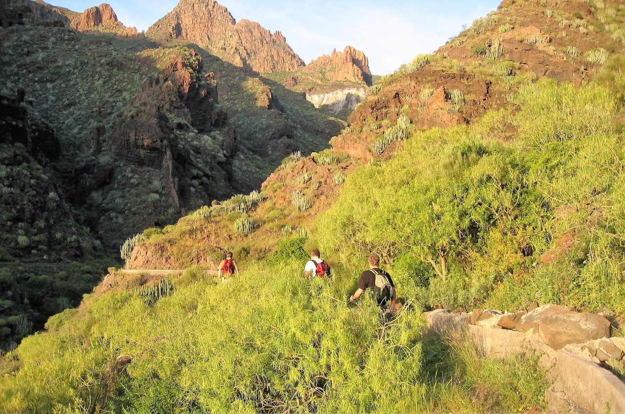
Walk 2.) - The cliff path to the cliff tunnel, through this and path up to the upper tunnel. Through this to the tourist trail (Camino Rejal) back to Los Gigantes. About. 12 km. 3 - 4 hours.
This trip starts with the easy-to-walk cliff path, but can bring challenges to participants who are not so used to hights. After a couple of kilometres, leave the cliff path and follow a steep track to the waterchannel and a 700 meter long tunnel to Barranco Mancha de Los Dias. The Waterchannel lies at an altitude of approx. 200 m asl. and is followed a few hundred meters before the path takes up the barranco to the upper tunnel which is approx. 450 m asl. and is about one kilometer long. At the other end of the tunnel, one is close to the tourist trail camino Rejal, which is followed down to Los Gigantes.
Walk 3.- Via Camino Rejal to Santiago del Teide (it is also possible to take a bus to save time and effort). Well marked trailes and less known, very spectacular trails back to Los Gigantes. About. 20 km. 4 - 6 hours.
The walk from Los Gigantes via camino Rejale to the small town of Santiago del Teide, goes in very varied and beautiful scenery. The distance is approx. 9.5 km. and the difference in altitude approx. 1000 meters. One must count 2 - 3 hours on this first part of the trip. After a coffee break, possibly also lunch, at one of the restaurants in the city, follow Camino Rejal back about one kilometre to a crossroads. Turn right and shortly after left again. Then follows a easy walk, mostly slightly downhill, and past an old farmhouse until we reach the upper path of Barranco Mancha de los Dias. Eventually we arrive at the formerly cultivated plateau Guama, crossing this to the well marked tourist trail that is followed down to Camino Rejal and back to Los Gigantes.
Walk 4.) - To the house of the Quermados and back. Aprox. 22 km. 5-7 hours.
The Camino Rejal is followed to Santiago del Teide (or a bus from Los Gigantes). After a coffee break, possibly also lunch, at one of the restaurants in the city, we walk the trail up to the memorial of Virgen de Lourdes to the little chapel. Then break north to the uppermost ridge in Barranco de Natero (straight above the Masca road). From here there is a clear and mostly easy walk to the casas de los Quermados and further back to Los Gigantes. There are several alternatives from casas de los Quermados, and all are relatively easy-going.
Share this page